UN
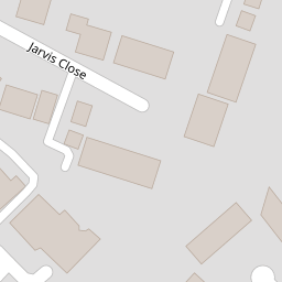
5 Jarvis Close
£ 468,000
Description
We don't have a Description for this property.
- Bedrooms
- 2
- Bathrooms
- 0


Leaflet © OpenStreetMap contributors
The heatmap indicates the level of crime in the area. The color of the heatmap indicates the crime severity and recency.
Metrics Year-on-Year
- Average area value
- 611,244.00 £Decreased by 15.06 %
- Average area rental value
- 2,619.00 £/moIncreased by 31.34 %
- Est rental Yield
- 5.14 %Increased by 54.82 %
- Crime Rate
- 12.00 %Unchanged by 0.00 %
from 719,645.00 £
from 1,994.00 £/mo
from 3.32 %
from 12.00 %
Nearby Schools
| Name | Type | Ofsted | Distance |
|---|---|---|---|
| Underhill Infants School And Children'S Centre | Children's Centre | 0.39 KM | |
| Underhill School | Community School | Requires improvement | 0.58 KM |
| Whitings Hill Primary School | Community School | Outstanding | 0.83 KM |
| Queen Elizabeth'S School, Barnet | Academy Converter | 1.21 KM | |
| Foulds School | Community School | Good | 1.29 KM |
Images
Nearby Streets
| Name | Average Price | Average Sqft | Distance |
|---|---|---|---|
| Oyster Close | £ 725,000 | 0 | 0.00 KM |
| Spring Close | £ 0 | 0 | 0.00 KM |
| Dormer Close | £ 665,000 | 0 | 0.00 KM |
| Hill Close | £ 525,000 | 0 | 0.00 KM |
| Hermes Close | £ 0 | 0 | 0.00 KM |
Nearby Transport
| Name | NLC | TLC | Distance |
|---|---|---|---|
| New Barnet | 6018 | NBA | 4.19 KM |
| Hadley Wood | 6075 | HDW | 4.63 KM |
| Oakleigh Park | 6020 | OKL | 4.99 KM |
| Mill Hill Broadway | 1527 | MIL | 5.55 KM |
| Potters Bar | 6022 | PBR | 6.13 KM |
Nearby Listings
| Address | Price | Type | Score | Distance |
|---|---|---|---|---|
| Darlands Drive, Barnet, Hertfordshire, EN5 | £ 1,060,000 | BUY | Unknown | 0.13 KM |
| Chesterfield Road, Barnet, EN5 | £ 790,000 | BUY | 7 / 10 | 0.13 KM |
| Sellwood Drive, Barnet | £ 200,000 | BUY | 6 / 10 | 0.14 KM |
| Darlands Drive, Barnet, EN5 | £ 875,000 | BUY | 7 / 10 | 0.17 KM |
| Darlands Drive, Barnet, Hertfordshire, EN5 | £ 995,000 | BUY | 7 / 10 | 0.18 KM |
Nearby Properties
| Address | Price | Distance |
|---|---|---|
| 25 Jarvis Close | £ 96,000 | 0.00 KM |
| 12 Jarvis Close | £ 190,000 | 0.00 KM |
| 4 Jarvis Close | £ 250,000 | 0.00 KM |
| 10 Jarvis Close | £ 287,500 | 0.00 KM |
| 23 Jarvis Close | £ 120,000 | 0.00 KM |